


When the Union Pacific Railroad was racing west to meet the Central Pacific in the late 1860s, there was some argument about whether the best transcontinental route lay north of Great Salt Lake or to the south. The local Mormons were keen for it to run south and thereby get their capital, Salt Lake
City, UT, on the main line, but Union Pacific surveys showed the northern route was better. The Central Pacific had also decided to grade north of the lake, and the two lines finally connected at Promontory
in 1869.
Eventually, a line would be built south of the lake to connect Salt Lake City directly with Oakland, CA, but this was not until the Western Pacific completed its route in 1909. Until then, the city had to make do with a branch line connecting with the transcontinental railroad at Ogden to access the California coast.
This page has photos of the old grade built by the Central Pacific and largely abandoned when the Lucin Cutoff was completed across the lake in 1904. I've driven the grade several times, and the photos on this page are from various different visits.


There are several roads that run from UT Hwy 30 south to points along the old grade. To reach the western end, you take Exit 376 off the I 80 onto NV Highway 233 (at the Utah border, this becomes UT Highway 30) and drive about fifty-five miles north-east before turning onto Grouse Creek Road, above, and driving another five miles.
You can access the eastern end of the grade by driving about 8 miles west on the Golden Spike Loop Rd from the Golden Spike NHS at Promontory, but the photos on this page track west to east, so we start at Umbria Junction.

Above, looking along Grouse Creek Road to the site of New Lucin explored later on this page.


Left, a sign at the location, one of many along the grade put up by the Bureau of Land Management. They are pretty weathered and shot up in places.
Replacement versions were installed at various locations along the grade but not at Umbria Junction.
Above, looking west along the grade towards Umbria Junction from Grouse Creek Rd. While, except for a few inaccessible portions, you can drive the entire grade east from Grouse Creek Rd to Promontory, you cannot drive west from this point to Umbria.
It's about a mile and half to Umbria Junction and back from here. The grade is firm and level but, in places where bridges no longer exist, there is some scrabbling to be done. Depending on the time of day, it can also be very hot, so take water with you if you decide to walk the grade.


Above, looking west along the grade at Umbria Junction.
Above, looking west at the point where the old Central Pacific grade joined the current grade. There were never any buildings or other facilities here. The railroad line on the left was completed in 1904 by the Southern Pacific, successor to the Central Pacific, to connect to the Lucin Cutoff.
The cutoff was built at a cost of $1,600,000. It ran 102 miles from Ogden, UT, to Lucin, crossing the Great Salt Lake on a twelve mile long straight trestle, slicing forty-four miles off the original route and eliminating that route's curvature and grades. The trestle was replaced in the late 1950s with a  parallel causeway.
Click this link to open a 360º panorama
of this location:


Above from the top, views along the grade approaching Umbria.


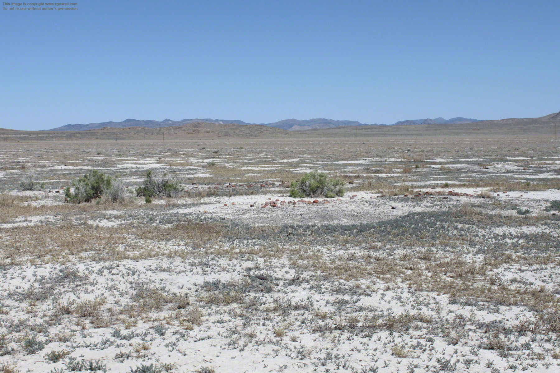
Above, half a mile east of Umbria Junction, the grade widens, indicating the original location of Umbria. The view above is looking east, towards Lucin from the site. There is no BLM sign, but, right, a couple of concrete foundations on either side of the grade mark the location.
There was a siding here and evidence suggests dugouts and other structures. These would have been built in 1869 as the railroad line was laid
east, but the site was probably only occupied for a short time by European and Chinese railroad workers.


Above, looking west from the original site of Umbria towards Umbria Junction.

Bottom view, looking east towards Lucin from the original site of Umbria.


Above, the remains of a bridge that once crossed an outer wash of Grouse Creek.


Top view, the main Grouse Creek channel. Lower two views, crossings further east on the grade.


Above, approaching Grouse Creek Road, the grade curves to the north-east.

The original township of Lucin was on the old grade about a half mile north east of the intersection with Grouse Creek Road. When the Lucin Cutoff was built, the township and name were relocated to the current site.
Throughout its life at both locations, the population of Lucin consisted mainly of employees of the Central Pacific and, after it leased the railroad in 1885, the Southern Pacific. Locomotives could take on water here, which was piped from the Pilot Range south-east of the settlement and stored in ponds.


The township was abandoned in 1936 but was briefly resettled in the 1960s by a group of retired railroad workers. By 1972, however, they had left. Today, nothing remains at the site except a bullet-pocked sign, some foundations of the old railroad buildings and the tracks of what is now the Union Pacific Railroad.
The name Lucin came from a local fossil bivalve, lucina subanta. There is also an apple-green,
chert-like mineral that can be found in the area, which is variously known as Lucinite, Utahlite or Variscite.

Above, the trees at the site draw their moisture from the old water ponds.

Above, looking across the Union Pacific line to the remnants of the railroad buildings at Lucin.

There is evidence of considerable activity in the area surrounding "new" Lucin, some of it possibly post 1942. From the 1870s, it must have provided
a transshipment point for copper and iron ore
mined in the northern third of the nearby Pilot Range. However, the low quality of the ore combined with milling and metallurgical
difficulties led to a progressive decrease in production until, in 1955, operations were abandoned.
The east bound leg of the wye at "new" Lucin curves across the middle of the view below.


Top view above, looking north-west along the modern Union Pacific grade. Lower view, looking south-east. The Lucin Cutoff begins about fifty-five miles on from here.
Services continued to run over the old
Promontory Division after the Lucin Cutoff was opened, although in diminishing numbers, until the rails were ripped up in 1942 (the metal contributed to the nation's war effort). To accommodate interchange between the two lines, an S-shaped section of track was built from the original grade to a wye at Lucin that connected both east and west bound traffic. The section of track to Umbria Junction from where the S-shape line turned off was abandoned.

Above, the grade connecting to the eastern wye leaves the old grade curving to the left.


Above, the eastern arm of the wye.
Click this link for a 360º panorama:


Above, three views along the western arm of the wye.


Above, a double track spur leads up to extensive remains about half a mile north of "new" Lucin.


Above, a spur to the east connects to the old Central Pacific grade.


Above, the remains of various wooden structures in the area.


Above, foundations of other structures.
Click here for a 360º panorama:


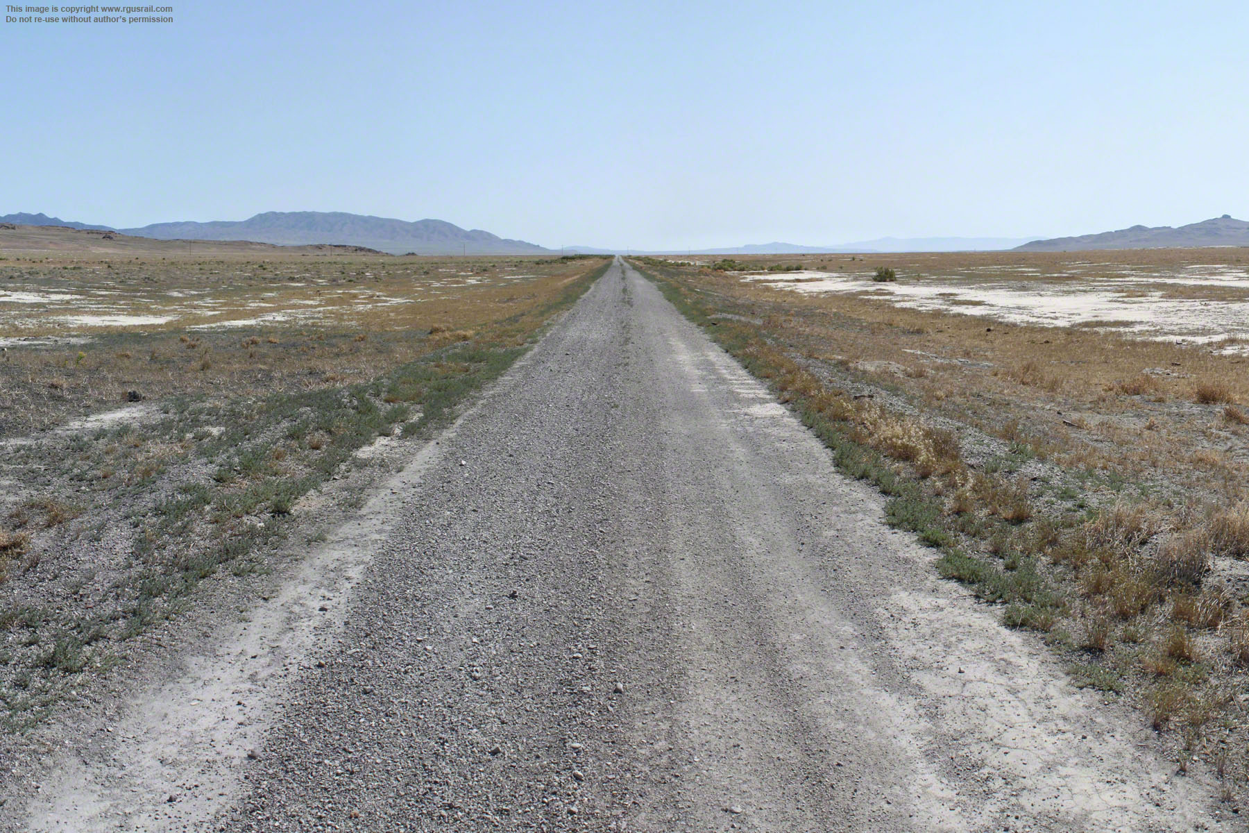
Top, about a mile from "new" Lucin, where the original Central Pacific grade intersects Grouse Creek Road, there are two signs giving some historical background on the grade.
The grade can be driven almost its entire ninety mile length from here to Promontory, but a 4-wheel drive is recommended. The going may look easy at this point, but the grade is completely unpaved, there are some deep gullies along the way and, in summer, it is very hot. There are no facilities or services, either, so go prepared. Take extra water and food, and make sure someone knows where you are.
Click here for a 360º panorama:


"Historic" Lucin is a half mile east of Grouse Creek Road. It was established in 1875 after the site at Umbria was abandoned. In 1904, "historic" Lucin was renamed Grouse when "new" Lucin was established. The site was abandoned in 1907.
There is very little to see here. There was a foreman's house and train car body on the north side of the grade, as well as a section house and a Chinese men's house on the south side. Top right, what may be the wooden foundations of the train car body. Middle right, the muddle of bricks suggests this was may be the site of the foreman's house.
Click here for a 360º panorama:


Bottom view, the remains of either the section house or Chinese men's house.


Bottom view, looking north-east along the grade from "historic" Lucin towards Medea Siding.


Above, a wood braced culvert just east of "historic" Lucin.


Above and right, a single stringer trestle with wooden wings. None of the trestles along the grade is strong enough to take the weight of modern vehicles. The "flashed" posts at either end are to alert drivers to the hazard.
When first built, in the rush to get to Promontory, many of these bridges were laid on simple timber sills. The subsequent work of "piling" was carried out by mainly Chinese section gangs. Piling entailed digging deep holes to take wooden foundation poles. Without these, the bridges were prone to wash out when heavy rains fell. Piles were also supported by "riprap" (rocks, boulders, used boiler bricks and other trash) to reduce under cutting.


Above from the top, looking west, looking south and looking north.


Above, another type of wood braced culvert approaching Medea Siding.


Medea Siding is six
miles north east of "historic" Lucin. It was established in 1899 to service local sheep ranches. There were never any facilities at the site, and sheep were probably loaded onto stock cars directly from temporary pens at the siding.
The siding had a short life. It was removed in 1906, a few years after the Lucin Cutoff opened.
The Cutoff greatly reduced traffic on the grade. Only three
trains a week passed through compared to ten a day previously, but ranches in this area were close enough to take their stock to "new" Lucin


Above, looking along the grade at Medea
Siding. Click here for a 360º panorama:


Above, three views looking the bed of the siding at Medea.


A little east of Medea Siding, a double pier wooden trestle.


Top view above, looking east over the trestle towards Bovine.


Bovine was a section station established in 1869 as the Central Pacific laid track east. A siding was laid to the north of the main line. It was named after herds of wild cattle roaming the area, apparently abandoned by emigrants heading west.
Facilities at Bovine originally included a section house with outhouse, train car body, Chinese bunk and cook houses, as well as a water tank. According to contemporary Southern Pacific station plans, section gangs also built a freight platform and replaced some of the Chinese bunkhouses in 1885.


Above, looking east along the line of the old Bovine siding towards Walden Siding.

Bottom, the remains of the old railroad
facilities. Click here for a 360º panorama:


Occupation of Bovine was mainly during the 19th Century.
It was probably abandoned with completion of the Lucin Cutoff, although the siding continued to be used by local ranchers until services on the line ceased entirely in 1942.

Above, a stone-lined culvert with a small wooden trestle just east of Bovine.


Walden Siding is about six miles from Bovine. It was constructed in 1898, probably as a place for locomotives to pass one another. There were never any facilities here.
Middle view below, looking west along the grade back towards Bovine.


Above, view east along the old siding.
Click this link for a 360º panorama:


Watercress is two
miles east of Walden Siding.
There is no record of Watercress in the 19th Century and it was probably established in 1910 after Terrace was abandoned east of here and the water line rerouted through to the Lucin Cutoff.


Above, looking north at Watercress.
Click this link for a 360º panorama:


Above, looking west from a position to the north of the original grade.
There were no living quarters or station buildings here but, in the 1920s, it served as the main
freight station for local ranchers. Railroad documents from 1926 record that the site
included a freight siding, a loading platform, barn, corrals and a water tank at which locomotives could replenish. It's difficult to believe looking at the site today but there was apparently an abundance of watercress in the area, which gave the location its name.


Above, these concrete foundations are to the south of the grade, possibly for the water tank.

Above, the ruins of what the National Park Service has identified as a root cellar at the site.


Top view, a shallow depression reveals what was once a stock pond.


Terrace was established in April 1869 as the maintenance and repair depot for the entire Salt Lake Division stretching over two hundred miles from Ogden, UT, to Wells, NV. Facilities included a sixteen stall quarter-roundhouse, eight track switching yard, coal shed, water tank, machine shop, railroad offices and a combined depot and hotel.
A twelve mile wooden aqueduct initially supplied water for domestic and railroad use from springs in the Grouse Creek Mountains. It was replaced by a metal pipe in 1887.


Bottom photo, looking west across the foundations of the Car Inspector's office.

Above, foundations of the Machine Shop located just to the west of the roundhouse.


Terrace was the largest of the Central Pacific townships built in Utah.
Businesses lined a wide avenue north of the old grade and included a school, Wells Fargo office, railroad and telegraph agents, a Justice of the Peace, two hotels, a saloon, barber, restaurant, postmaster, general store and mill, groceries and meat markets and a fruit and vegetable supplier. There was also a communal structure known as the Athenium, with bath houses and library or reading room. Residents were asked to pay a small local tax to support the facility.

Above, looking south across the remains of the combined depot and hotel. Business buildings lined a wide avenue to the north of the depot. Residential buildings were mainly to the south of the tracks.
An 1880 census reported the Chinese population at Terrace was about fifty-five persons. They occupied an area at the east end of the township and consisted mainly of railroad employees, but included a storekeeper, a grocer and a laundry owner. The only woman was a twenty-eight year old prostitute!

Above, from their location, these appear to be the remains of the blacksmith shop.
Above, the remains of the Central Pacific offices and shops at Terrace to the south of the grade.
At its peak, the township had a population of about a thousand people, including some five hundred Chinese. The Central Pacific grade from Sacramento, CA, to Promontory, UT, was laid mainly by Chinese labourers brought in from Canton. Faced with chronic labour shortages early on, Charles Crocker, a principal investor and Central Pacific Board member, had pushed for their recruitment and they proved to be hard working, sober employees. After completion of their work, many stayed on at townships along the road as railroad workers, storekeepers, launderers and waiters.

Above, looking north across the area where the businesses were located.


The depression shown above reveals where the sixteen stall quarter-roundhouse stood.


Top, looking west across the old marshalling yard. Middle and bottom, looking east.


Above, the coal chippings lying in these views looking south-east confirm that this was the location of the coal house to the east end of the railroad yard.
Terrace was almost entirely dependent for its existence on the railroad and began an inevitable decline after the Lucin Cutoff was opened. There also appears to have been a serious fire at some time in the early 20th Century (dates of 1900 and 1907 have been given), which hastened the process. Nevertheless, the township clung on for a few more years, still boasting the services of its Justice of the Peace and Constable in 1908. Finally, the maintenance shops were moved to Carlin, NV, and in 1910, Terrace was abandoned.


Above, just to the east of the old township is Terrace cemetery. Sadly, vandals have been at work and very few headstones survive intact.


Bottom view above, the grade curves to the north shortly after leaving Terrace.


Old Terrace is a mile and a half east of Terrace. There was probably never a settlement here but heavy traffic in and out of Terrace may have required a back up siding.
Below, looking south along the old grade back towards Terrace.


Above, looking north along the grade.
Click this link for a 360º panorama:


An aqueduct from Grouse Creek Mountains may have terminated at a water storage tank here.
The enclosure made of pipes in concrete posts in the background of the photo below is
bare, but may have contained a grave or graves.

The enclosure is similar to a graveyard enclosure at Kelton, thirty miles east of here.


Artifacts at Old Terrace are scarce except for an occasional glass sherd or piece of metal.


Six miles east of Terrace is Red Dome Siding.
It was completed in 1895 to meet
increased railroad activity and possibly to serve the needs of
local ranchers. There appears never to have been any settlement here.


Above, two views looking south along the
grade. Click here for a 360º panorama:


Top view, looking east along the siding. Middle view, looking west.


Above, three views taken progressively further along the grade heading towards Matlin.


Above, a dressed stone culvert half a mile west of Matlin.


Matlin is four miles east of Red Dome.
Track laying crews reached the location in April 1869. Chinese labourers built section facilities and a small settlement was established. Click here for a 360º panorama:


Above middle and bottom, looking south-west along the grade back towards Red Dome Siding.


Middle view, the trace of the east line of the wye. Bottom view, the trace of the west line.


Top view, looking along the siding to the north of the grade at Matlin. A wye was installed at Matlin in 1900, possibly to replace a light duty turntable. The line of ties curving away to the right in the lower view above shows the trace of the eastern arm of the wye.
There is very little evidence remaining of their occupation now, but Southern Pacific records reveal that fifteen people lived here in 1870 and twenty-five in 1876. Since these figures do not include the Chinese residents, the actual figures were probably two or three times these numbers. Like many of the settlements along the old grade, Matlin was abandoned soon after completion of the Lucin Cutoff in 1904.


Middle view above, the western arm of the wye. Bottom view, the eastern arm.


The siding at Romola was built in 1899 to meet increased rail traffic and the needs of local ranchers.
A loading platform and train car body were located here, but no settlement. Click here for a 360º panorama:


Lower two views, nothing remains at the site now, except for the faint trace of the old siding.


Gravel Pit is four miles east of Romola.
Click here for a 360º panorama:


Facilities included a section house, kitchen, Chinese house, train car body and water tank.


Top view, looking south along the old grade back towards Gravel Pit. Lower view, looking north from the same location as the grade curves to the north-west approaching Ombey.
In places like this, the undulating landscape called for long shallow embankments. The Central Pacific was paid $16,000 per mile in thirty-year 6% government bonds to build over easy grades, $32,000 per mile in the high plains and $48,000 per mile in the mountains. However, the cost per mile varied depending on the actual terrain. In 1888, a Senate Select Committee estimated the cost to the Central Pacific of its seven hundred and thirty-seven mile line at about $36,000,000, although this was disputed at the time.


Ombey is one mile east of Gravel Pit. In about 1879, a siding and small settlement were established here. Left, like many of the markers along the grade, the old was badly shot up.
Click here for a 360º panorama:


Middle view, looking north along the grade. Bottom view, looking south.


Railroad facilities at Ombey appear to have been established when those at Gravel Pit were abandoned, and comprised a section house, tool house, bunk house and cook house. They also provided freight services to local ranchers.
Above, looking across the site of the settlement at Ombey to the west of the grade. Archaeological investigations have identified the population as mainly Chinese. Estimates suggest c.10,000 Chinese labourers worked on the Central Pacific in 1866-1869. In the following years, they moved on to construction of their railroads in the US, including the Denver & Rio Grande Railroad, the Oregon Short Line Railroad and the Northern Pacific Railroad.


Above, a view from the start of the southern arm of the wye.
A wye was built here in 1900 probably to turn the locomotives used as helpers over the grade from Red Dome Siding. Apparently as many as four were needed on heavy freight trains.
Top view, looking north-east across the wye with the southern arm entering from the left. Middle view, looking along the northern arm of the wye.

Above, two views looking across the site of the settlement at Ombey to the west of the grade. Archaeological investigations have identified the population as mainly Chinese. Estimates suggest c.10,000 Chinese labourers worked on the Central Pacific in 1866-1869. In the following years, they moved on to construction of other railroads in the US, including the Denver & Rio Grande Railroad, the Oregon Short Line Railroad and the Northern Pacific Railroad.
Railroad facilities at Ombey appear to have been established when those at Gravel Pit were abandoned, and comprised a section house, tool house, bunk house and cook house. They also provided freight services to local ranchers.


Above, three views along the grade as it heads towards Peplin.


Above, four miles from Ombey, the grade enters a cut. There is no vehicle access through the cut..

Old Railroad Grade Road leaves the old grade at the cut shown in the previous three views. Top right, a view of the east end of the cut from the road.
Peplin is a mile and three quarters east of the cut, four and three quarter miles from Ombey, located on the grade in the centre of the view on the middle right. It appears to have been created in 1888. Prior to that, there is no record of it on Central Pacific or Southern Pacific maps. It consisted of a bumper spur, stationary car body and loading platform. There may have been a small settlement there at some time.


Further on, a view from Old Railroad Grade Road as the grade curves north round Peplin Mountain. The road is about 100' below the grade here.


Above, the grade drops from the eastern flank of Peplin Mountain.


Above, the grade then crosses Old Railroad Grade Road and skirts the edge of Great Salt Lake.


A single track was installed at Zias Siding in about 1902 probably to serve the growing needs of local ranchers. It was abandoned in 1906.
According to the National Parks Service survey, a small refuse dump was also located on the site.


Middle view above, looking west along the grade. Bottom view, looking east.


Top view, the new information sign has been placed on Railroad Grade Road.


Above, this box culvert with wooden wings at the western end of Kelton crosses Indian Creek which runs south from the Raft River Mountains towards Great Salt Lake, although it is mostly dry it must
be said. The culvert's wings and posts are
probably California redwood. Wooden structures like these were creosoted to protect them from the elements, and a very faint bloom of the old creosote can still be seen on the wings of this culvert.
When the first, mainly Chinese, section hands arrived here in 1869, the location was initially named Indian Creek after this creek. However, it was soon renamed Kelton in honour of a local stockman.

The residential and business area was to the north of the main line, the railroad facilities mainly to the south, with bunkhouses to the south-
west. The Idaho Forwarding Company had an office adjacent to the
depot, and a stock yard to the south-east of town served the local ranchers.
There were about a hundred people living at Kelton in 1870 and, in the late 1870s, its population peaked at about two hundred, plus an
undocumented Chinese population of some size. In 1880, it boasted a two story hotel, a post office, blacksmith shop, stables, two liquor stores, three general stores and a salt works. There was also a store selling "Drugs and Notions, Books, Stationary" that served as agent for the Stage Company.
Above, looking west along the grade.
Click here for a 360º panorama:
Various railroad buildings once stood at Kelton, including a depot, turntable, engine
house, water tank, pump house and section house, as well as spurs and sidings. By 1900, a wye had been built west of the town to handle the heavier locomotives. Water was piped seven miles to the settlement from the foot of the Raft River Mountains. Large water cisterns were located here and daily trains of water cars ran to stations along the division.


Above, looking east along the grade towards Elinor.

Above, remains of the fenced section house at the north-west end of the town. The square concrete structure may the base of an outhouse.


Above, the hollow depression is all that remains
of the original roundhouse located west of the depot.
For a few years, Kelton thrived: in a typical year during the 1870s, six million pounds of supplies were loaded from trains at Kelton onto wagons in exchange for wool, furs and cattle. Kelton's prosperity began to decline when the narrow
gauge Utah & Northern Railroad line from Ogden, UT, to Butte, MT, was completed in 1881 and the Oregon Short Line Railway reached McCammon, ID, in 1882.
Above, two views across the site of the freight and passenger depot south of the main line.
Kelton was a station on the Salt Lake, UT, to
Boise, ID, overland mail and southern terminus of the Northwestern Stage Company until 1878, then the Utah, Idaho and Oregon Stage Company until 1886. During the 1870s, stagecoaches left town daily destined for Boise (a two day trip), Walla Walla (four days) and connecting with Oregon Steam Navigation Company ships at Umatilla on the Columbia River to Portland (five and a half days). Passengers and freight followed the so-called Kelton Road across the state line into
Idaho, on through City of Rocks and Rock Creek
to Boise.

Above, looking north across the remains of the engine house.


Top view, at the end of this raised spur
terminating just east of the engine house are the remains of a buffer stopper. Lower view, the spur overlooks the foundations of a pump house to the south.
By 1883, most stage, express, mail and freight traffic that had run from Kelton had been transferred to the connecting lines east of Great Salt Lake. The possibility of mining gold in the Black Pine district twenty-five miles north of
Kelton promised future riches in the 1880s, but these never eventuated. After 1904, the line
became a backup in case of problems on the Lucin Cutoff and regular trains dropped to weekly services.

Although it still served as a shipping point for local trade from Snowville, Yost and Park Valley, and supported a hotel, post office, general store and telegraph office, by 1937, the township's population had dwindled to just forty-seven. The end came in 1942 when the rails were ripped up and the township was abandoned.
Ironically, the cemetery at the north western edge of the old settlement shown on the views on the right has proved the most durable remnant, although it appears to have been the target of souvenir hunters and vandals down the years.


Above, looking across the site of the Kelton Hotel on the north side of the grade opposite the depot.

Above, debris covering the site of the business and residential buildings.


Above, the weathered remains of wooden fences that once surrounded individual graves.


Bottom two views, only the embedded tombstones have eluded the souvenir hunters.


The water facility above appears to have supplied water to the stock yard.

In 1869, Wheeler led a survey team through south-eastern Nevada and western Utah to prepare maps of the region for future military operations, road and rail building. They also catalogued natural resources and the location and population of Native American tribes, noted mineral resources, climate, geology, vegetation, water sources and agricultural potential.
No longer legible, the marker was inscribed with the latitude and longitude of its location. As far as I have been able to find out, it is the only Wheeler marker in Utah.
Above, a photo of the sign at the site of the Historic Wheeler Survey Marker just east of Kelton.
Right and lower right, the sand stone marker was installed by the survey party to form a stable base from which to make astronomical observations.

The sign's inscription reads:
Historic Wheeler Survey Marker
In 1869 the United States Army sent First Lieutenant George M. Wheeler on a brief reconnaissance which later created the Country's 'Geographical Survey West of the One Hundredth Meridian.' This survey gave our leaders the first accurate mapping of the Western half of the Country, collecting data of the natural history, geology, geography, climate, weather and ethnology.

When we last visited, the sign had collapsed, although the stone marker itself was still in place.


Elinor is five miles east of Kelton. Top view,
looking west along the grade. Lower view, looking east. A 2,300' long siding was built here in 1902 to accommodate increased traffic but there was evidently no settlement of any kind. Click here for a 360º panorama:
Railroads specified special roadbeds for arid regions subject to sudden, heavy rain falls such as northern Utah. These stipulated the height to which the bed must be raised above ground level, the width and depth of side excavations and the use of sand or other permeable material to drain water quickly and prevent the wooden ties from "pumping" or swelling with water.


Upper left, approaching the Old Railroad Grade Road intersection with Locomotive Springs Road five and a half miles east of Elinor. Upper right, looking west along Old Railroad Grade Road.
Lower left looking south down Locomotive Springs Road. Lower right, looking east along Old Railroad Grade Road. The fresh water lakes collectively known as Locomotive Springs are two miles south of here.
It's not clear how they got the name. It would be tempting to say that water was drawn from them to feed locomotives, but there is no record of this. James Williams' 1879 Pacific Tourist, curiously refers to the lakes as puffing out steam at times, which gave them their name.


Seco is six miles east of Elinor. It was established in 1873 to accommodate facilities moved from Ten-Mile, three and a half miles east. Evidence reveals the work crews at this section station were mainly Chinese. Although no official figures are available, about twenty-five people probably lived here at any one time during the height of the line's operation. Top view, looking west along the grade from Seco back towards Elinor. Bottom view, looking east along the grade towards Nella Siding. Click here for a 360º panorama:
A siding was built one and a half miles west of Seco in 1872, although it did not feature any structures of any kind.


Two photos below, just past Seco, the grade becomes very corrugated, overgrown and difficult to drive. However, Old Railroad Grade Road parallels the grade a few yards to the north.
Left, the Bureau of Land Management sign at Nella Siding.


Middle view above, looking west along the grade. Bottom view, looking east.


Top view, looking west along Old Railroad Grade Road towards Seco. Lower view, looking west towards Ten-Mile. Click here for a 360º panorama:
A siding at Nella was built in 1902 to service local ranchers and then removed in 1906, two years after the Lucin Cutoff opened. It was relaid in 1916 possibly to meet a sudden increase in local demand. In 1917, a car body and freight platform were located here, but there was never any settlement of any kind. The 1862 Pacific Railroad Act required construction of a telegraph line to parallel the line, which was built on the south side of the grade, i.e. on the right in the lower view above, but there is no evidence of it now.


Above, looking south west at Ten-Mile towards the old grade from just off the Old Railroad Grade Road with the Raft River Mountains in the distance. The gravel road in the upper right of the top view runs parallel to the old grade, which is too rough for anything but 4-wheel drives here.
A section station was established here in 1869 as the Central Pacific work crews built the grade east. The name was derived from its distance west of the Lake section buildings. There was a section house, train car body and water tank here but, in 1873, the facilities were moved to Seco. There is nothing left now of the facilities.
Click here for a 360º panorama:


The small settlement that once existed here took its name from Monument Rock, an outcrop in Great Salt Lake just south of the location. It was established in 1869. Click here for a 360º panorama:
In 1876, the population was twenty-five, some of whom were probably employees of the Central Pacific, others would have been employed on the Desert Salt Works to the south-west of the settlement. It's not clear when the works closed but, in later years, local ranchers still used a siding here. A wye was also in place from at least 1879.


Above, approaching Monument Rock from the west along Old Railroad Grade Road.
Top view above, looking west along the grade
back towards Ten-Mile. The northern flank of the Hogup Mountains are on the left horizon. A spur to the salt works ran off to the left from this point. Lower view, looking east along the grade. The North Promontory Mountains are on the middle horizon.
From Monument, the old grade skirts the south eastern flank of the Hansel Mountains and then makes a wide, 270° turn up over Spring Bay across Salt Wells Flat through Kosmo and Lake to Metataurus on the western flank of the North Promontory Mountains. The ten miles of grade from here are only intermittently driveable until a few miles north of Metataurus.


Top two views, Monument Rock. Bottom, looking south-west across the site of the salt works.

As is evident in the engraved vignette on the left above from James Williams' Pacific Tourist published in 1879 (p.167), in the 19th Century, Monument Rock was still surrounded by lake water.
As Williams describes it, "an isolated rock rises, like a monument, in the lake on the left, while the hill on the right is crowned with turrets and projecting domes. You have here a grand view of the lake, its islands and shores, with promontories, etc., which is correctly represented by our artist. The station itself is a mere side track and "Y" for the convenience of the road. When the strong south wind blows, the waves, dashing against the rocks on the shore, and the rolling white caps in the distance, form a beautiful view which the tourist, after passing the dreary waste, will appreciate".
The vignette is based on a Southern Pacific promotional photograph of the "Jupiter" at Monument in May 1869. It was taken by Alfred A. Hart, then official photographer for the Central Pacific. The "Jupiter" is carrying Leland Stanford and other Central Pacific dignitaries to Promontory for the ceremonial driving of the Golden Spike on 10th May.
You can browse this book from the books and manuals page of this website, as well as downloading a word searchable pdf version from there. You can also see photographs of a replica "Jupiter" on the NHS Golden Spike page of this website.


Top view, looking east from Monument. The old grade curves from the left. Lower views, progressively further along Salt Wells Road.


Above, looking south from Salt Wells Road to the location of Kosmo, five miles east of Monument.
Two sidings, were constructed here, the first in 1901 for the railroad. The second, built in 1912, served the Salt Lake Potash Company, which had a railroad spur, pools, canals and a processing station at the site. The section station at Kosmo comprised bunk houses, a cook house, garage, corral, general store, blacksmith shop, coal house and train car body to serve as the depot. Even long after the Lucin Cutoff opened, in 1924, some two hundred people still lived in Kosmo.


Above, a postcard showing workers mining the salt beds on Great Salt Lake, probably at Kosmo.
Above, three views from different points driving east along Salt Wells Road.


Top view, looking south-east from Cedar Springs Road towards the location of Lake. Lower view, looking north-west towards Lake from Utah 28400W. It is not possible to drive to this site.
Lake is four miles east of Kosmo. Conditions were wet out on the salt flat because of its proximity to the water table. This may have necessitated building two settlements a mile apart at West Lake and East Lake. East Lake, established in 1869, contained the railroad section buildings. A siding was then built at West Lake in 1877 and a wye in 1899. Both settlements were inhabited. In 1879, about one hundred people were recorded living there. The majority were probably Chinese labourers.


Above, three views of the grade as it curves south to join Utah 28400W.

Above and right, looking south approaching Metataurus. The Union Pacific grade cuts from the right at a lower elevation as it parallels the old Central Pacific grade.
Both railroads surveyed and graded hundreds of miles in advance of their rail head in an effort to secure the maximum commercial advantage. Although they did not need to actually lay rails, the 1864 Pacific Railway Act had increased land grants to each company from ten sections to twenty sections per mile graded (each section was 6,400 acres).


Above, looking north along the Central Pacific grade. The Union Pacific grade is to the left.
In fact, the Central Pacific hoped to lay rails as far east as what is now Evanston, WY, and had graded into Echo Canyon west of Ogden, UT. The Union Pacific had actually surveyed to the California coast and graded as far west as Wells, NV, before the decision was made to join the two lines at Promontory.
The competition resulted in some tension. At one point, Union Pacific workers were forbidden to work within 200' of the Central Pacific line but, by and large, the two construction crews worked alongside each other without incident. For example, when blasting cuts nearby, they quickly decided to notify each other before setting off the charge.


Above, three views along the grade heading east towards Metataurus.


Above, a view along the old Central Pacific grade looking north from the location of Metataurus five miles east of Lake.
The remains of the siding that was built here are hidden in the grass on the right of the view. There were never any facilities or a settlement here. After coming off Salt Wells Flat, the grade begins a heavy climb through Metataurus up the side of Lake Ridge on the west flank of the North Promontory Mountains. From here, it turns through almost 180° to the east covering sixteen miles to arrive at Promontory.

Above, a shallow cut on the grade just north of Metataurus.


Left the Bureau of Land Management signpost to the east of the grade at Centre.
There are very few records of Centre and no evidence of any facilities or settlement here. Click here for a 360º panorama:


Middle view above, looking west along the grade at Centre. Bottom view, looking east.


Top, a view along the bed of the old siding at Centre looking south. The Central Pacific grade is on the right and the very faint line of the Union Pacific grade is on the upper right. Lower view, looking south along the old grade. The Stansbury Mountains are in the distance.
The siding was apparently built in 1879 but had fallen into disuse by 1890. Because the entire grade was formed of only a single track, sidings like the one here at Centre were built to permit trains to pass each other without holding up sections of the line. As locomotives became more powerful and faster, however, Centre was probably no longer used because of its proximity to Rozel just three miles east.


Above, three views progressively along the grade heading towards Rozel.


Rozel was originally named "Victory" on 30th April 1869 when Central Pacific workers rested for lunch after laying six miles of track during the famous "ten-mile race".
For more on the race, see the Golden Spike NHS page on this website.


Above, two vies along the grade.
Click here for a 360º panorama:

Above, looking south-west across the site of the railroad facilities.
A siding was built at Rozel two and half miles east of Centre in 1869 and, later, a wye. It was an important stop, as helper engines were attached here to assist freight trains heading east up through Promontory Hollow.


There are few remains at the site, but it's uncertain if any are from the 19th Century.
About twenty-five people are recorded living here in 1870. Other structures mentioned include a section house, train car body, bunk house, cook house and water tank.
Like many sites along the grade, however, Rozel declined after the Lucin Cutoff was opened. By 1917, the only facilities that remained were a water tower, freight platform and bake oven.


Below, looking east along the Central Pacific
grade. The Union Pacific grade runs in from the right. The lines start an eight mile climb from here to Promontory, established as the meeting place for the two railroads by Congress on 10th April 1869. One month later, on 10th May 1869, the last link in the nation's "first" transcontinental railroad was forged by the ceremonial striking of the Golden Spike.
You can pick up the story of the Central Pacific and Union Pacific grades from here on the Golden Spike NHS page of this website.

Three quarters of a mile east of Rozel, the backcountry byway ends. Above, there is an information sign at the site with an outline of the route west.
It includes a short history of construction of the Transcontinental Railroad across Nevada and Utah.
Above, the Golden Spike NHS West Tour along the grade starts here running to Promontory.

Above, looking west along the Central Pacific grade back towards Rozel.
Related Links:
Central Pacific Railroad Photographic History Museum
Send a comment or query, or request permission to re-use an image.
Much of my information was drawn from Anan S. Raymond and Richard E. Fike's Rails East to Promontory, published by the Utah Bureau of Land Management in 1981 (click on the cover to search for this book on Bookfinder.com).
The content is available on line at:
www.nps.gov/.../online_books/blm/ut/8/contents.htm.